
Geotechnical instrumentation and monitoring, from design to data
PICO designs instrumentation programs, directs their installation, maintains instruments and remote monitoring systems, and analyzes the data, taking on whichever phases a project calls for. For contractors, engineering companies, and public agencies, anywhere in California.
Instrumentation design
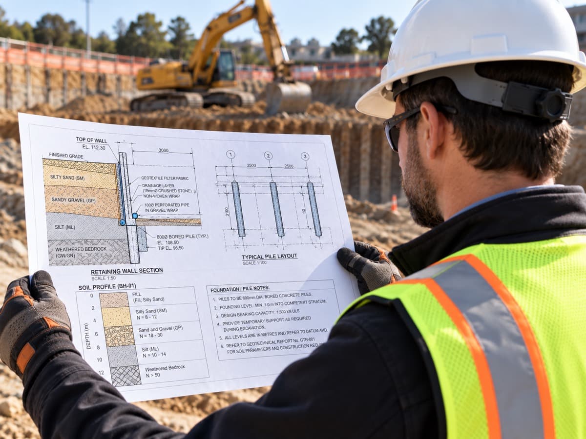
The instrumentation program is designed by a licensed geotechnical engineer, working from the project’s plans and specifications and accounting for the contractor’s sequence of construction: what the work may do to the ground and adjacent structures, and which instruments will provide early detection.
Included
- Instrumentation plan
- Instrument selection and specification
- Threshold values set with the design engineer
- Monitoring frequency and reporting schedule
- Instrumentation data submittal package for the client
Field installation
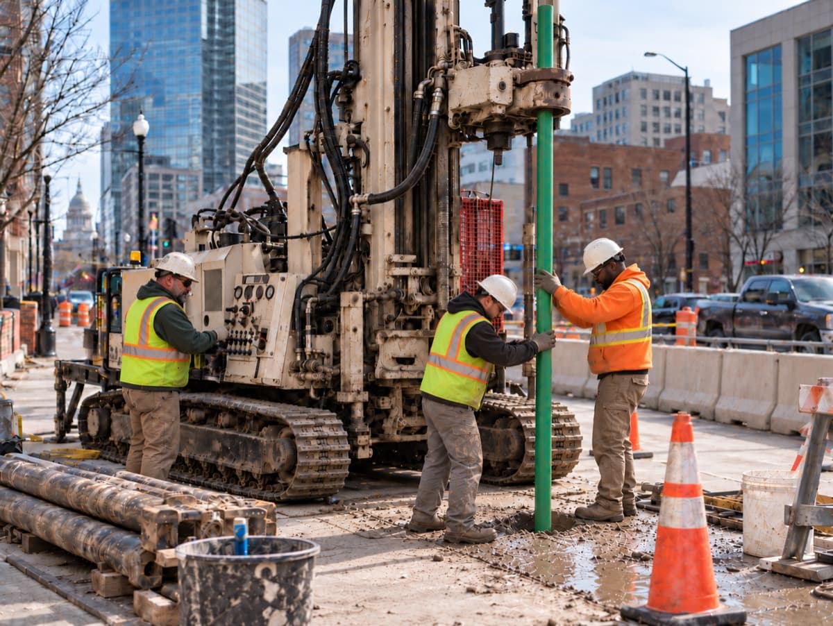
Installation is carried out by a licensed contractor in accordance with the instrumentation plans. PICO handles permitting, instrument acquisition, and subcontractor coordination, directs the installation, then calibrates each instrument and takes its initial baseline readings before it goes live.
Included
- Permitting
- Instrument acquisition
- Subcontractor coordination
- Instrument layout in the field
- Direction of the contractor’s crew
- Instrument calibration
- Baseline readings
- Hardware programming and commissioning
- As-built instrument locations
Monitoring and maintenance
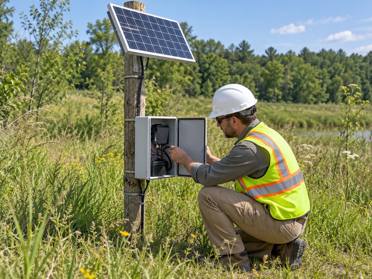
Instruments must report reliable data to be useful, so throughout the project PICO keeps them working: routine site visits, batteries and hardware monitored and serviced before they fail, reading frequency raised when the work gets close and lowered when it moves on. When the need for an instrument ends, PICO decommissions it.
Included
- Routine site visits
- Battery and hardware maintenance
- Reading-frequency changes as construction phases change
- Threshold review with the design engineer
- Instrument repair or replacement
- Decommissioning and removal at the end of the project
Data on PICO Monitoring
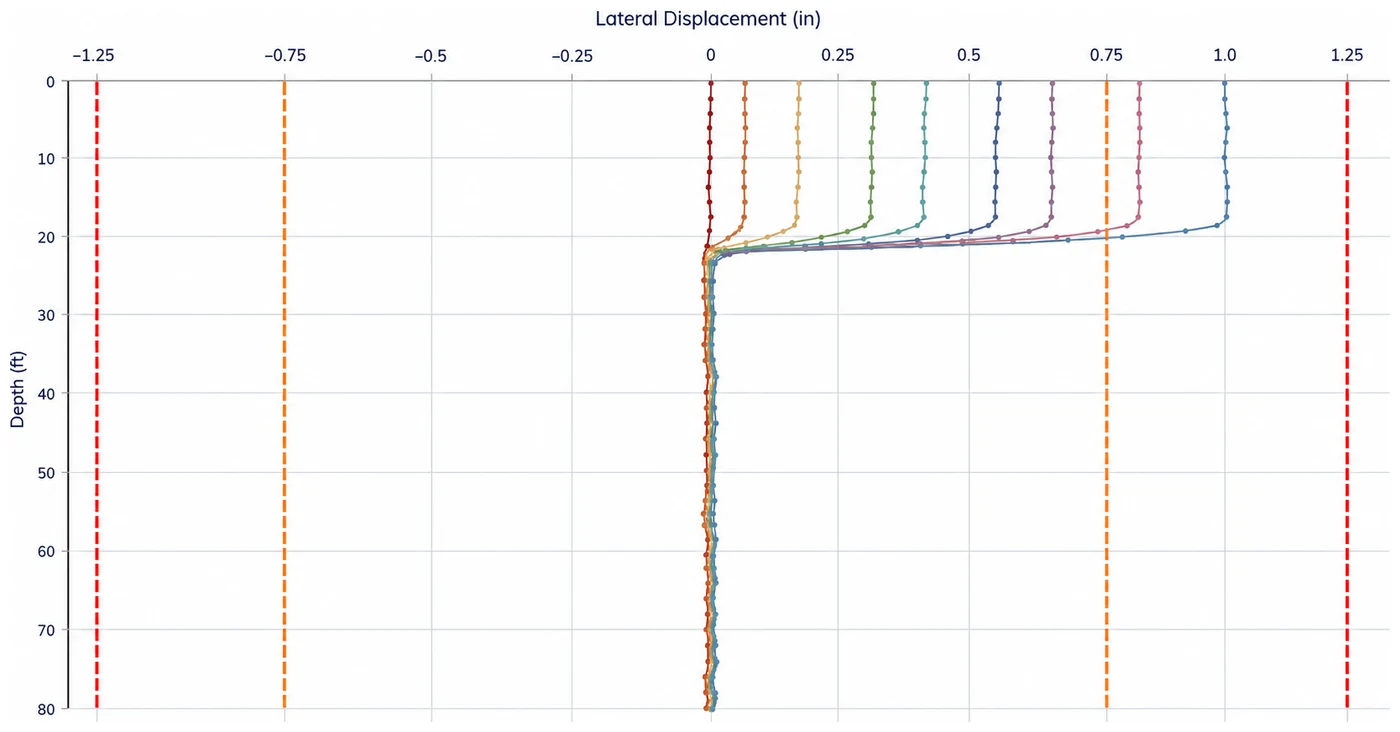
Readings are uploaded to PICO Monitoring at each instrument’s reporting interval. Plots are customizable and show the thresholds set for each instrument. When a reading exceeds a threshold, key personnel are alerted by email or SMS. The entire project team works from the same plots and the same site map. Monitoring reports are produced to the contract’s specification.
Included
- Readings on a set reporting interval
- Thresholds drawn on the data plots
- Alerts to named recipients when a reading crosses threshold values
- Site map of the instruments
- Monitoring reports to the contract’s specification
- Role-based access for the project team
Licensed engineering analysis
When engineering analysis is requested, a licensed geotechnical engineer reviews the readings and the monitoring reports, analyzes threshold exceedances, and identifies the trend heading toward one, with advice the project team can act on.
Included
- Engineering review of monitoring reports
- Engineer’s analysis of threshold exceedances
- Trend identification ahead of the threshold
- Attendance at construction meetings when instrumentation data drives a decision
What PICO instruments, and where
Instruments
- Piezometers
- Pore pressure in the ground and behind walls, vibrating-wire and standpipe.
- Inclinometers
- Lateral movement of shoring, slopes, and landslides, read in-place or by probe.
- Extensometers
- Displacement between anchors in rock, soil, and structures, single- and multi-point.
- Tiltmeters
- Rotation of walls, buildings, and bridge elements adjacent to the work.
- Crackmeters
- Movement across existing cracks and joints in adjacent structures.
- Strain gauges
- Load in struts, walers, piles, and reinforcement.
- Settlement cells and points
- Ground and structure settlement, at the surface and at depth.
- Load cells
- Load in tiebacks, anchors, and struts.
- Utility monitoring points
- Settlement and movement of pipelines and utilities beside or beneath the work.
- Automatic total stations
- Three-dimensional movement of survey prisms, read automatically on a set interval.
- Survey prisms
- Targets on structures, walls, and track, read by total station.
- Vibration monitors
- Ground and structure vibration from piling, demolition, and heavy equipment.
- Noise monitors
- Construction noise at the site boundary and at sensitive neighbors.
Projects
- Deep excavations
- Shoring movement, ground loss, and groundwater around the excavation.
- Tunnels and shafts
- Settlement troughs, convergence, and the structures over the alignment.
- Shoring and retaining walls
- Deflection, anchor loads, and pore pressure behind the wall.
- Adjacent-structure monitoring
- Buildings, utilities, and rail beside the work.
- Dams and levees
- Seepage, pore pressure, and movement through construction and after.
- Bridges and transit
- Foundations, abutments, and structures beside or over the work.
- Slopes and landslides
- Movement at depth and the groundwater that drives it.
- Embankments and surcharge
- Settlement and pore pressure during consolidation.
Statement of Qualifications
PICO’s general Statement of Qualifications — one document for your team.
- Firm data
- Core competencies
- Relevant experience
- Contact